Above:
HyTES instrument on ER2 aircraft. NASA’s ER-2 high-altitude Earth science aircraft is used for environmental science, atmospheric sampling, and satellite data verification missions.
HyTES
Looking Down for NASA and ESA
Daniel Wilson
The Hyperspectral Thermal Emission Spectrometer (HyTES) is an airborne imaging spectrometer with 256 spectral channels between 7.5 and 12 micrometers in the thermal infrared part of the electromagnetic spectrum and 512 pixels cross-track. HyTES was developed originally to support the Hyperspectral Infrared Imager (HyspIRI) mission and is currently supporting science data products for future ESA missions as well as NRC 2017 decadal survey missions and SBG. SBG is the Surface Biology and Geology designated observable identified in the
NRC 2017 Decadal Survey (PDF):
"Thriving on Our Changing Planet: A Decadal Strategy for Earth Observation from Space."
(For PDF documents download Adobe Reader)
SBG has candidate measurement approaches that are similar to the HyspIRI mission concept that we have been developing over the past decade. HyspIRI included two instruments mounted on a satellite in Low Earth Orbit. There is an imaging spectrometer measuring from the visible to short wave infrared (VSWIR) and a multispectral thermal infrared (TIR) imager. The VSWIR and TIR instruments will both have a spatial resolution of 60 m at nadir. HyTES provided the HyspIRI Team data at much higher spatial and spectral resolutions to help determine the optimum band positions for the HyspIRI-TIR instrument as well as provide precursor datasets for Earth Science research in the TIR.
Key MDL components used in HyTES include IR sensing detectors (Quantum well infrared photodetector arrays), concave diffraction gratings, black silicon coatings, and precision slit design.
http://hytes.jpl.nasa.gov
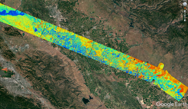
HyTES thermal map acquired for the California central valley in support of NASA’s ECOSTRESS evapotranspiration science product. Imagery taken at 65K feet on NASA’s ER-2.
+ Larger image
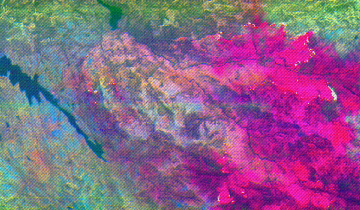
Ammonia filled plumes (in Magenta) emitting from fires in Northern California (August 9, 2018). Imagery taken at 65K feet on NASA’s ER-2.
+ Larger image

