Above:
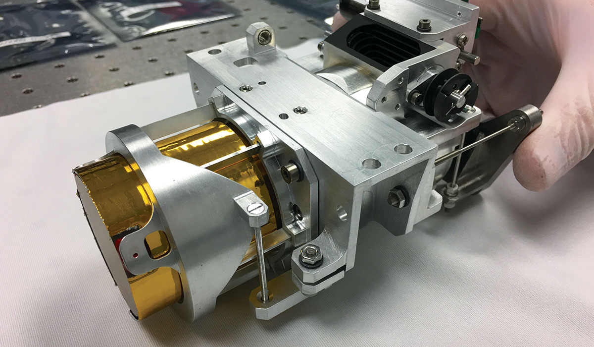
The Snow and Water Imaging Spectrometer represents the first space spectrometer compatible with CubeSat dimensions that can simultaneously observe bright snow and dark water.
SWIS
Two for One: Water & Snow
In spaceflight, getting two sets of important scientific data for the price of one is always a benefit. The snow and water imaging spectrometer (SWIS) combines the ability to image spectra from the dark surface of the coastal oceans and bright snow nearby simultaneously.
Previous technologies have succeeded in imaging both oceans and snowy peaks, but always with separate instruments, many of which must be flown in airplanes. JPL researchers recognized the value of a spacecraft that could continuously monitor both types of terrain using just one instrument in Earth orbit. Observing the interaction between freshwater runoff from snow and glaciers, and how it mixes with the saline shoreline waters, is critical to understanding the effects of changing temperatures on plankton and other sea life in these environments. Designed to fly in a compact CubeSat configuration, SWIS utilizes a high dynamic range to accomplish imaging spectra from both snow and water, which run the gamut from blindingly white to a dark blue.
The trick to achieving this is a detector with a fast readout, combined with a spectrometer that possesses high sensitivity. JPL has decades of experience in designing extremely sensitive, high-precision spectrometers, but placing such a broadly capable instrument in a small package is a very challenging task. In the past, a single spectrometer capable of observing just one of these regions was typically about the size of a dishwasher. Using sophisticated optical design; SWIS compresses the technology required for both tasks to a 6U CubeSat about the size of a traffic pylon, with correspondingly lower power requirements. But data are only as useful if the quality is high. SWIS contains an onboard calibration capability to assure that the data received is of consistently high quality over the life of the spacecraft. A small constellation of such satellites would allow for continuous observation of Earth’s coastlines, critical to understanding the dynamic changes that take place there. Examples include the coasts of Greenland and the Antarctic, where freshwater flow from glaciers and icy cliffs impinge on the saline ocean environment of the shoreline, dramatically altering the ecology of the region. Traditional spectrometers can gather vast amounts of data but have little dwell time when carried over the region in aircraft. SWIS can take its time, creating denser measurements of a given area and generating more in-depth observations. SWIS has the added advantage of using many off-the-shelf parts, resulting in lower cost. In this era of melting glaciers, diminished snowpacks, and encroaching drought, technology such as SWIS is critical to enhanced, round-the-clock monitoring of these resources and coastal marine ecosystems from a stable platform in space.
SWIS is small enough to be flown as a ride-along on the open decks of commercial communication satellites, resulting in greatly reduced cost of operation.
+ Larger image
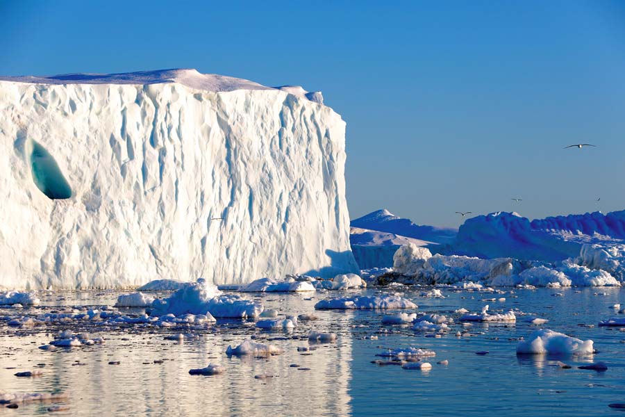
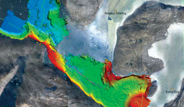
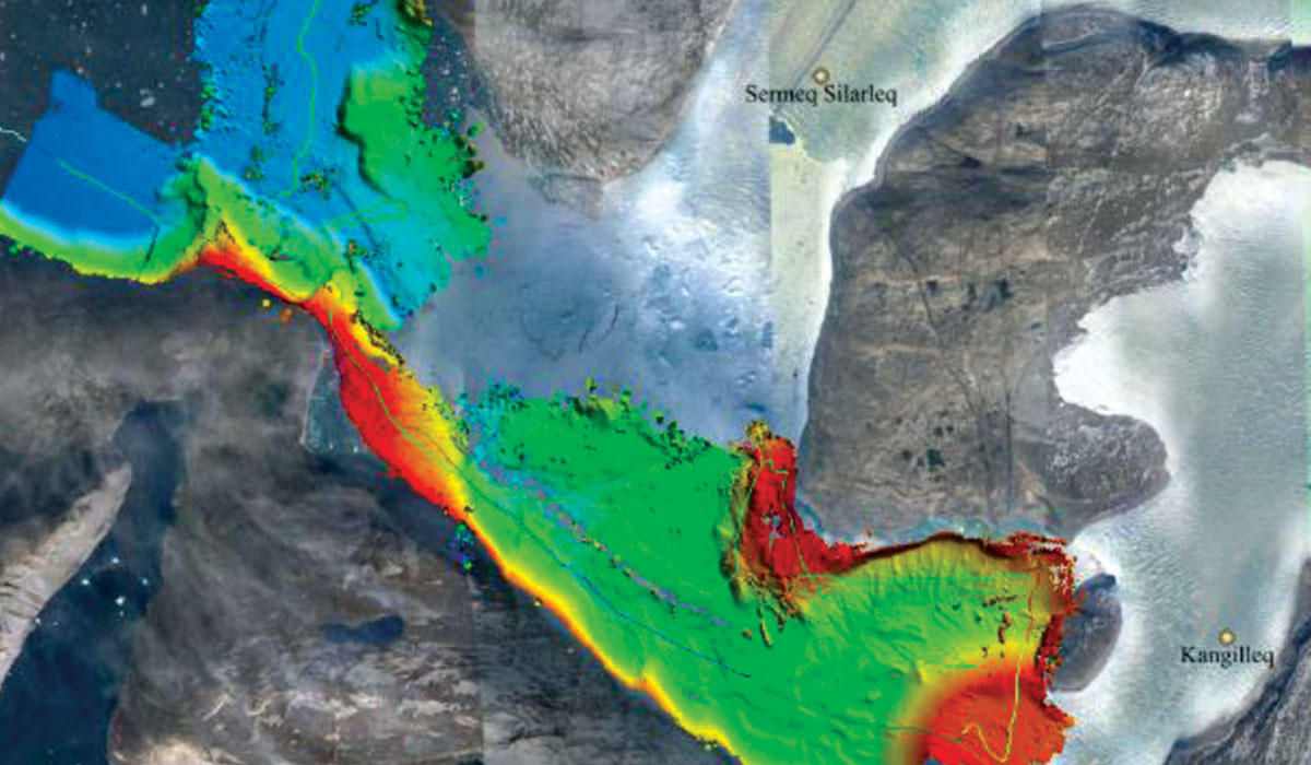
The ability to observe icy or snow-covered coastal environments are critical to monitoring interactions between freshwater runoff and saline coastal ocean waters.
+ Larger image
